
Location: Seattle, Washington
Cost: Pro bono
Size: 2,800 SF
Completion Date: 2017
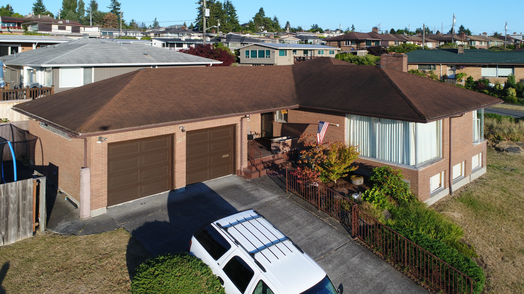
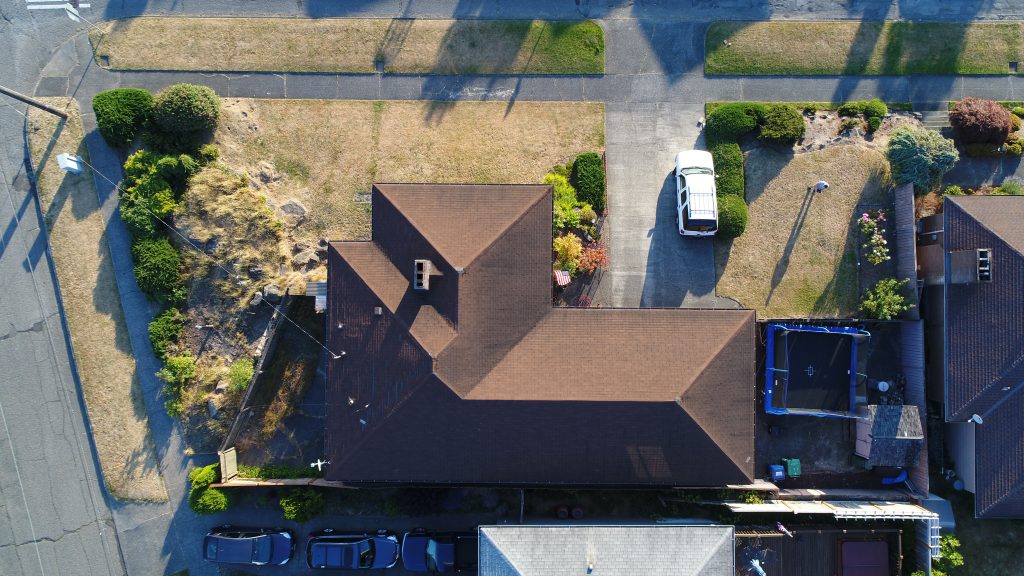
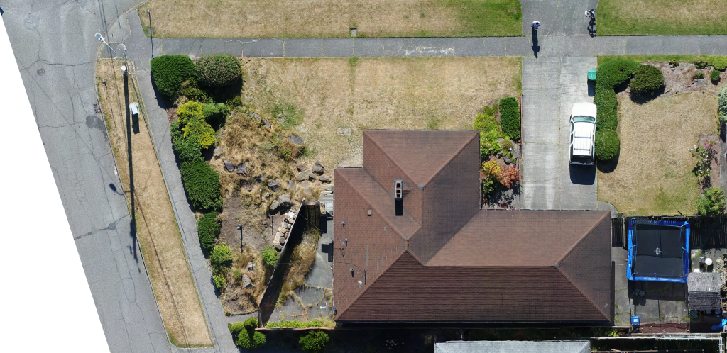
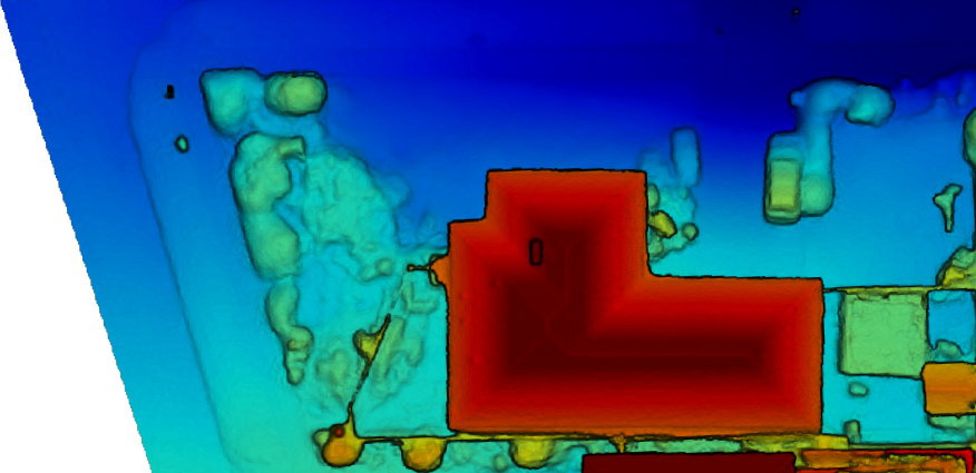
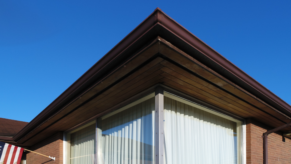
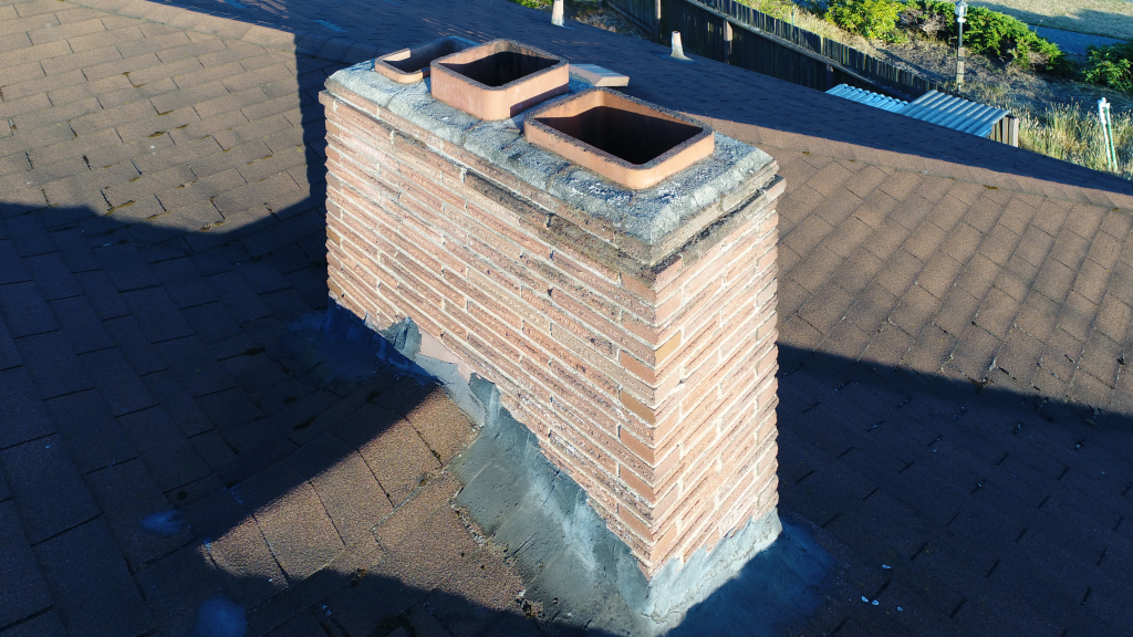
Documentation of this National Register eligible residence was completed with new drone technology and serves as an example of the drone’s capabilities. As a baseline sUAS, it is capable of creating high resolution aerial photographs to better illustrate the structure. The drone also has the capability for upward views to observe conditions below eaves and downward views for objects below the drone. While the baseline drone can take aerial photographs, the lens distorts the image presenting unreliable documentation. Supplementary software is capable of being programmed to perform a survey creating orthographic projections of the objects below and merging the images together. Supplementary software is also capable of creating topographic maps and maps of vegetative health. As a new tool for documenting existing and historic buildings, structures, and sites, the drone is an excellent tool, though limited to visual observations only. Such visual observations may expose conditions not visible from the ground or high up on a building.